Fugro was founded in 1962.It has over 250 offices, about 7,000 staff and a permanent presence in almost 60 countries. Fugro’s organisation comprises of three divisions: Geotechnical Services, Survey Services and Geoscience Services.
I have specialized in spatial data processing. All software developed by Activesoft used MS-Visual C++, C, C#, .NET technologies, WinForms.
The major applications and libraries designed and developed by Activesoft are:
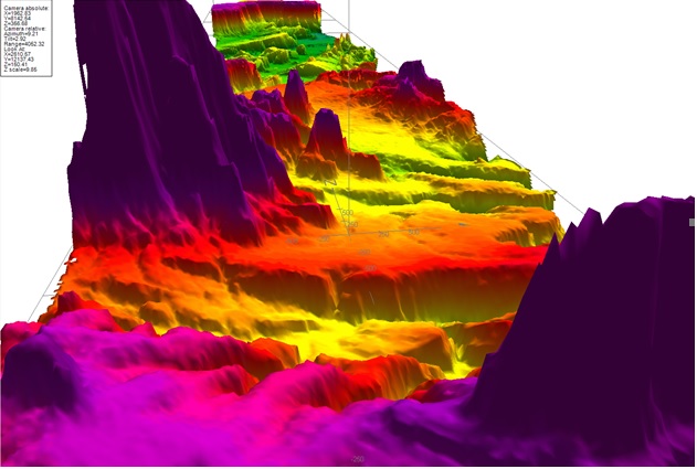
- 3D spatial data visualization .
- 3D graphics engine based on OpenGL. Lighting, shading, textures, display lists, etc. Implemented as ActiveX control.
- Real-time displays for sensor data such as Pitch, Roll, Heave, etc.
- Starfix.Interp – Marine seismic data acquisition and processing. Sophisticated multithreaded application developed using MFC C++. Real-time data acquisition using sound card technology, GPS input, real-time displays and printing to thermal or window printers, real-time archiving. Automatic seabed tracking. DSP: digital filters – Band Pass, TVG, swell filter, Stack filter. Geophysical interpretation – digitizing reflectors, labels, tidal adjustments.
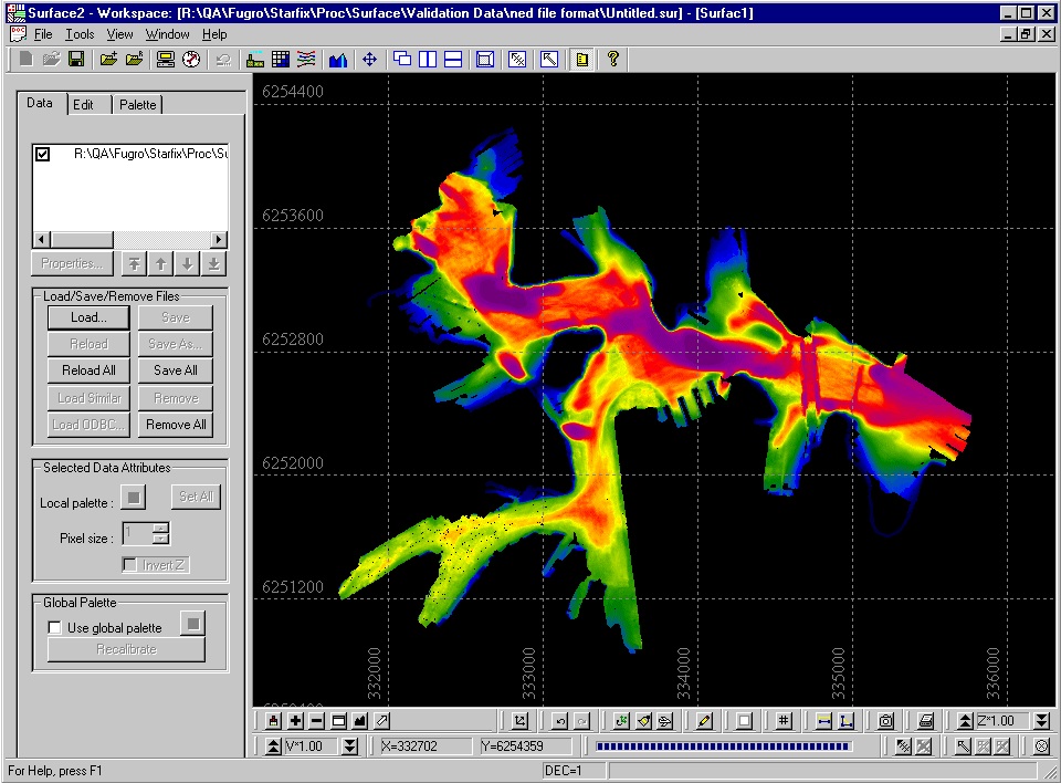
- Contouring engine. Generates contour lines and labels of the 3D surfaces.
- Gridding engine – Parabolic, hyperbolic, minimum curvature, kriging, triangulation, etc. Creates surfaces from 3D points.
- Spatial data IO and rendering (3D data points).
- Grid/TIN IO and rendering (3D surfaces).
- Geo-referenced Images IO and rendering (raster data). Draping images over 3D surfaces using texture mapping techniques.
- Vector IO and rendering (FME – Feature Manipulation Engine, 3D CAD data, Microstation, Autocad, ESRI, etc).
- Cross/Long sections, profiles, etc.
- Interactive graphics – editing of 3D spatial data.
- Swath Editor – multibeam, sidescan sonar displays.
- Multibeam and backscatter processing.
The software developed by Activesoft is used on all continents in all Fugro data processing centers.