Micromine

Activesoft has designed and implemented a number of software projects for Micromine. 

The most significant are:

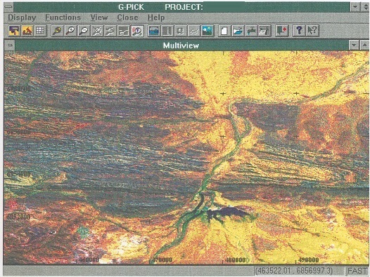
GPICK – Mining Exploration Data Processing 

  1. Developed using object-oriented Microsoft Visual C++ technology. 
  2. This program is entirely written in C++ using MFC – Microsoft Foundation Classes. 
  3. The conceptual aspects have been specified by mining engineers. 
  4. Activesoft has designed and implemented object oriented functional interface, and behavior. 
  5. The major components are: Generic Display Form Class – All GPICK parameter screens are derived 
  6. from this class inheriting varieties of field types and automatic field verification. 
  7. Support for storing multiple parameter sets. 
  8. Graphical Display Class – all GPICK graphical displays are derived from this class inheriting 
  9. real world coordinate system, drawing functions, zooming, panning, etc. 
  10. The first release was in June 1995.
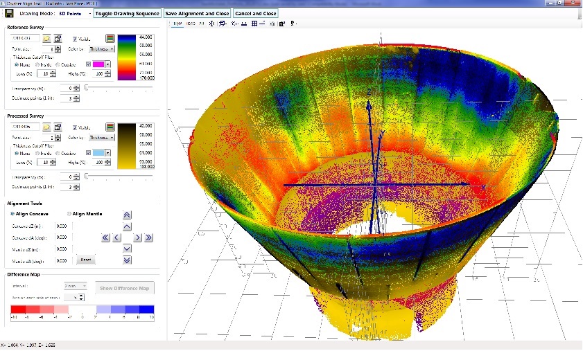
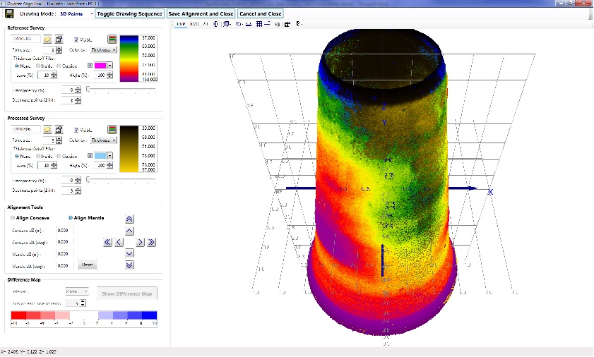
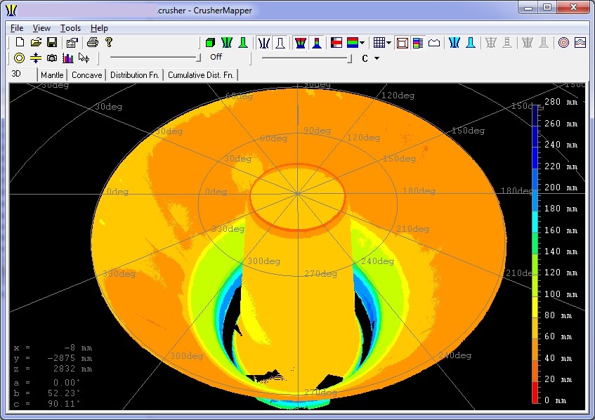
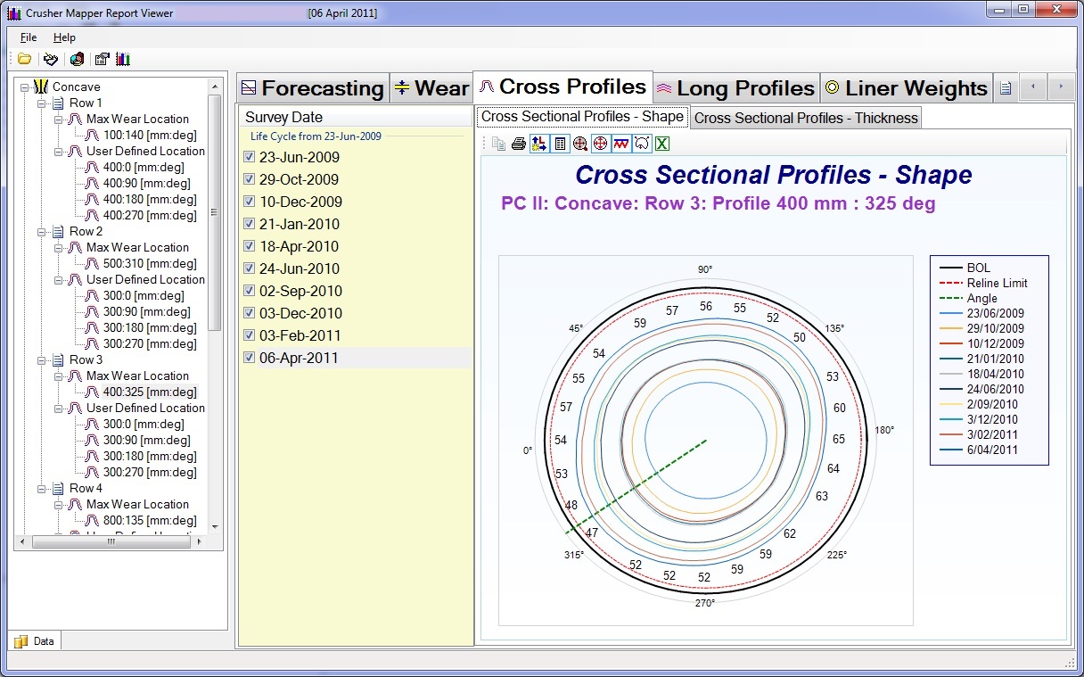
MICROMINE

This is original Micromine Mining software product with hundreds of sales worldwide.  Activesoft has contributed thousands of hours in maintenance and developing new modules. 

ENSIN – Engineering Seismic Interpretation

  1. Real-time DSP seismic data acquisition and processing. 
  2. The working environment was PC using C, Intel assembly and TMS-320C30 assembly.
  3. Major components are: Message driven graphical interface. 
  4. Video DOS device drivers for 16 and 256 colours. 
  5. Embedded system on the DSP card with TMS320C30 processor, 2 channel analog input, and 2 channel analog output. 
  6. The software on the card involved interrupt driven data acquisition of trigger and data channels, band pass filters, TVG-time varied gain filters, Stack-moving average filter, swell filter, seabed detection, digital amplifier, spiking and predictive deconvolution filters, passing commands and data between PC and DSP card. 
  7. SCSI – device driver for tape drives. 
  8. Interfacing 9 – track tape drive for SEG-Y format (seismic data storage standard). 
  9. Interrupt driven serial communication library for receiving GPS navigation fixes. 
  10. Graphical displays such as: Oscilloscope, Profile recording and playback, Interactive digital filter designs for spiking and predictive deconvolution (multiple reflection removal), FFT – fast Fourier transform. 
  11. Digitizing reflectors on seismic data and calculating 3D real world coordinates using navigation fixes. 
  12. Exploring DMA chip. The ENSIN system was entirely designed and implemented by myself. 
  13. The field consulting was provided by a professional surveyor/geophysicist. 

FTR – Digital Audio Control

Future Technology Resources specializes in digital audio recording of the courtroom proceedings. The main product For The Record allows the full workflow management of recorded audio, transcription, and evidence. The product is based on the Client/Server architecture.

Activesoft’s main responsibilities were maintaining, designing and developing new components on the Server side of the product. The Server application is the central part of this product. All workstations/clients login into Server and use its services. It controls database access, activities, allocation of system resources and maintains integrity of data (audio, documents, evidence).

  1. The whole product is developed using MS-Visual C++. 
  2. The Server is a sophisticated multithreaded application. 
  3. It is using ODBC for the database access. 
  4. The SQL-Server database is used on the large installations (multiple clients) or Jet database is used on the standalone or portable systems.
  5. The recorded data can be archived in real-time to the tape drives (such as DAT ) or disk devices such as MO-Magneto Optical drives, ZIP drives, CDs, etc.
  6. The multiple users can be connected to the Server performing different operations such as recording, playback, life audio listening (confidence monitoring), archiving, restoring, annotating, transcribing, querying database, etc. 

Some of the interesting components Activesoft has designed and developed are:

  1. Windows Sockets communication between all client/server applications.
  2. Life audio transmission over LAN.
  3. VOX – automatic voice switching. The audio recording can be automatically switched on and off depending on the audio input energy levels.
  4. Data replication. Automatic/Scheduled replication of database, audio file, 
  5. documents and attachments/evidence to any other Server on LAN.
  6. Archiving to tape devices using SCSI interface.
  7. Notification mechanism – the server can notify client applications of some important or critical events using Sockets broadcasting over LAN.

In addition to the above Activesoft has greatly contributed to the general robustness of the Server application by constantly enhancing its functionality, reliability, and performance.

The product is marketed and sold worldwide. It’s been sold to South East Asia, Australia and USA.

FTR has received a number of awards. It has won 1st price in the Emerging Exporter Of The Year category in Western Australia and two weeks later received 1st price in the same category for the whole of Australia.

RPS – VEGA 3D Land Survey Design

3D Land Survey Design and Analysis. Developed for ECL – Exploration Consultants Limited. Now owned by RPS. 

Vega Features Vega contains many of the functions and utilities required for the QA/QC of SPS positioning data. 
It also includes manipulation, editing and production of new SPS data file sets. 

RPS Features:

  1. Single or multiple SPS data file importing, with source and receiver location display on a georeferenced (X,Y) background. 
  2. Display manipulation, including Pan, Zoom, Rotation, Grid Lines and Background Color etc. 
  3. Point-and-click measurement of distances and angles between displayed points. 
  4. Display Window image capture from selectable region with saving to image file or Windows Clipboard. 
  5. Formatted printing of Display Window to any Windows printer, including Acrobat PDF Writer (if installed). 
  6. SPS point-and-click interrogation of Source and Receiver properties on-screen. 
  7. SPS data relationship checking, either graphically or from scrollable source and receiver point lists. 
  8. Selection Tool for point-and-click source or receiver moving or deletion. 
  9. Enclosure Tool for multiple point selection for source and receiver point moving or deletion. 
  10. Writing of new SPS data file sets once points have been edited, including updated Relationship Files. 
  11. Import, register and display of single or multiple graphic image files, such as topographic maps and satellite images for underlaying on SPS point position data displays. 
  12. Image layer manipulation to change image display stacking order. 
  13. Binning calculation and displays, including 
  14. Fold displays, either color palette coded or numeric values in each bin. Midpoint Scatter display, showing CMP locations for every valid source/receiver pair. Offset Range display, either color-coded or bar graph, showing CMP offset distribution for every valid source/receiver pair. Azimuth display, either color-coded Average Azimuth or “Spider Plot” displays of CMP azimuth distribution for every valid source/receiver pair. Offset and Azimuth spider plots, showing azimuth and relative offset for every valid source/receiver pair. 
  15. Single Bin mode for query and display of attribute analyses for a single bin as the mouse cursor is moved over the main bin grid analysis display. 
  16. All binning CMP coordinate, offset and azimuth data saved to proprietary binary database files for speed of access. 
  17. SPS format compliance checking, including automatic detailed report generation to> Rich Text Format (RTF) files for use in report generation. 
  18. 3D display capabilities of Binning computations, including full surface rendered modeling of fold contribution, point elevations, etc. 
  19. Analysis “calculator” provides the means to produce new bin content analysis files by perfomring arithmetic calculations on two separate analysis files, such as subtraction, addition, average, min and max. 
  20. Exporting of a single bin analysis attribute for all bin grid cells to text files for quantitative analyses of computed or result analysis files. 
  21. Integrated scanning of maps and charts into the image registration utility using any Twain compliant scanner. 

Tronox – Realtime Barge Control

Dredging extension allows:

  1. Barge Updates – real time, display statistics, barge and cutter head positions.
  2. Barge Views – allows operator to select one or more centerlines and design boxes while mining.
  3. Operator’s view option – maintains operator’s view 3D camera position while mining.

Currently used by Tronox Pond Mining – dredging operation north of Perth.

TMT – Reatime Heerema Seismic

Heerema is a modern application developed using .NET C# technologies for TMT – Total Marine Technology/ Woodside Heerema project.

The main objectives of this application are to acquire data from the underwater drill hole survey, create 3D model and perform volume calculations.

TMT – Reatime Heerema Seismic Features:

  1. The input data is collected in real time. 
  2. The application is able to control and configure Digital Pipe Profiling Sonar device.
  3. In addition to this there is depth Z and Heading inputs from the serial COM port.
  4. All collected data is synchronized, merged in real time and displayed in 3D graphical view.
  5. The 3D graphical view allows Zooming, Panning, Rotations in all directions.
  6. Some selection and editing tools are provided in 3D graphics.
  7. The collected data is saved into the session files.
  8. These files can then be reloaded at any later time for further editing and processing.
  9. The program also has automatic filtering to remove unwanted spurious data points.
  10. It provides tools to construct solid surfaces.
  11. The surface can be displayed in 3D graphics as well. 
  12. It can be color coded by deviations from the nominal cylindrical shape. 
  13. This highlights any cracks or non smooth abnormalities in the drill hole shape.
  14. It has tools to specify and display horizontal cross section of the hole.
  15. It is horizontal ring slice of the hole data displayed in any orientation including plan view over grid type axes.
  16. Some measurement tools are provided in 3D graphics such as Distance between two points.
  17. The program can calculate volume inside constructed drill hole surface between specified elevations.
  18. The final report displays Volume vs Depth Chart.
  19. The Data Simulator is provided for the development testing and/or training purposes.

Fugro – Spacial Data Processing

Fugro was founded in 1962.It has over 250 offices, about 7,000 staff and a permanent presence in almost 60 countries. Fugro’s organisation comprises of three divisions: Geotechnical Services, Survey Services and Geoscience Services.

I have specialized in spatial data processing. All software developed by Activesoft used MS-Visual C++, C, C#, .NET technologies, WinForms.

The major applications and libraries designed and developed by Activesoft are: 

  1. 3D spatial data visualization . 
  2. 3D graphics engine based on OpenGL. Lighting, shading, textures, display lists, etc. Implemented as ActiveX control.
  3. Real-time displays for sensor data such as Pitch, Roll, Heave, etc.
  4. Starfix.Interp – Marine seismic data acquisition and processing. Sophisticated multithreaded application developed using MFC C++. Real-time data acquisition using sound card technology, GPS input, real-time displays and printing to thermal or window printers, real-time archiving. Automatic seabed tracking. DSP: digital filters – Band Pass, TVG, swell filter, Stack filter. Geophysical interpretation – digitizing reflectors, labels, tidal adjustments.
  5. Contouring engine. Generates contour lines and labels of the 3D surfaces.
  6. Gridding engine – Parabolic, hyperbolic, minimum curvature, kriging, triangulation, etc. Creates surfaces from 3D points.
  7. Spatial data IO and rendering (3D data points).
  8. Grid/TIN IO and rendering (3D surfaces).
  9. Geo-referenced Images IO and rendering (raster data). Draping images over 3D surfaces using texture mapping techniques.
  10. Vector IO and rendering (FME – Feature Manipulation Engine, 3D CAD data, Microstation, Autocad, ESRI, etc).
  11. Cross/Long sections, profiles, etc.
  12. Interactive graphics – editing of 3D spatial data.
  13. Swath Editor – multibeam, sidescan sonar displays.
  14. Multibeam and backscatter processing.

The software developed by Activesoft is used on all continents in all Fugro data processing centers.

CrusherMapper

CrusherMapper is a technology delivering significant savings to crushing operations through extended liner life, reduced shutdowns time, and greater productivity. 

It represents a quantum leap in the measurement, modeling and management of crusher liner maintenance.
Inventor of the year 2007 award in WA.

The software was developed using C#, .NET technologies, WinForms, WPF, OpenGL, DirectX, VSTO, .NET Chart, ChartFX, C++, COM, C.

Activesoft has designed and developed company’s software suites: MillMapper and CrusherMapper.

CrusherMapper Functionality:

  1. Automatic clean up and segmentation of laser scanned data points. 
  2. Automatic normalization/orientation of laser scanned data points.
  3. Creating crusher 3D model from segmented/normalized laser scanned data points.
  4. Calculating volumes and weights of crusher liners.
  5. Calculating liner wear rates at different profile locations.
  6. Calculating forecasting for relining crushers.
  7. Drawing of 3D geometry of crushers including Concave and Mantle. All drawing is done using OpenGL and DirectX technologies.
  8. Automatic/software data analysis and generating report database.
  9. Sophisticated data repository with automatic spatial data processing and analysis wizards.
  10. Automatic/Programmatic report document generation using VSTO – Visual Studio Tools for Office.
  11. Designed & developed full processing suite for mining crushers.
  12. Designed & developed repository storages for all operational data. Multiple clients, sites, devices, surveys, acquired/processed/reports data. This repository consists of raw data, processed data, images, databases for different purposes, proprietary file formats. The size of repository is now many terabytes and growing.
  13. Forecasting algorithm using history database and forecasting simulator. 
  14. Manual alignment tool of XYZ laser data points using interactive 3D graphics under Direct3D.

Scanalyse MillMapper

MillMapper is a world-first patented technology delivering significant savings to mining milling operations through extended liner life, reduced shutdowns time and greater productivity. 

It represents a quantum leap in the measurement, modeling and management of mill liner maintenance and mill charge.
Inventor of the year 2007 award in WA.

All software is developed using C#, .NET technologies, WinForms, WPF, OpenGL, DirectX, VSTO, .NET Chart, ChartFX, C++, COM, C,.
Activesoft has designed and developed company’s software suites: MillMapper and CrusherMapper.

Scanalyse MillMapper Functionality:

  1. Automatic clean up and segmentation of laser scanned data points. 
  2. Automatic normalization/orientation of laser scanned data points.
  3. Creating mining mill 3D model from segmented/normalized laser scanned data points.
  4. Calculating volumes and weights of mill liners.
  5. Calculating ball charge weight and volume.
  6. Implemented an algorithm for detecting balls (spheres) and their sizes from the cloud of point obtained from laser scanner device.
  7. Calculating liner wear rates at different profile locations.
  8. Calculating forecasting for relining mills.
  9. Drawing of complex 3D geometry of mining mills including Feed, Shell, Discharge. All drawing is done using OpenGL and DirectX technologies.
  10. Automatic/software data analysis and generating report database.
  11. Sophisticated data repository with automatic spatial data processing and analysis wizards.
  12. Automatic/Programmatic report document generation using VSTO – Visual Studio Tools for Office.
  13. Designed & developed full processing suite for mining mills.
  14. Designed & developed repository storages for all operational data. Multiple clients, sites, devices, surveys, acquired/processed/reports data. This repository consists of raw data, processed data, images, databases for different purposes, proprietary file formats. The size of repository is now many terabytes and growing.
  15. Forecasting algorithm using history database and forecasting simulator. 
  16. Manual alignment tool of XYZ laser data points using interactive 3D graphics under Direct3D.

Scanalyse BallSize

BallCharge is a modern application developed using .NET C# technologies and DirectX graphics that loads a laser scanner cloud of data points which represents the balls inside mining mills.

The algorithm to automatically locate and determine the size of each ball was invented and developed by Activesoft. It calculates statistical distribution of the ball sizes and produces report chart.